By Douglas Scott
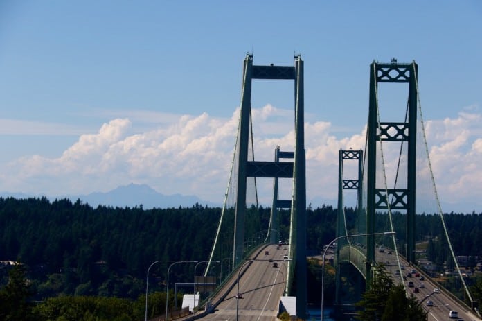
 On November 7, 1940, a bridge spanning between Tacoma and the Kitsap Peninsula became one of the most well-known bridges in America. Affectionately nicknamed “Galloping Gertie,” the original Tacoma Narrows Bridge became one of the longest suspension bridges in the world, coming in third behind the Golden Gate Bridge and the George Washington Bridge.
Only four months and six short days after the bridge opened to the public, however, a windstorm came through swinging the bridge violently back and forth before the bridge collapsed into into its watery grave 195-feet below. The bridge’s collapse was filmed and photographed. The images were seen by millions around the nation and the world.
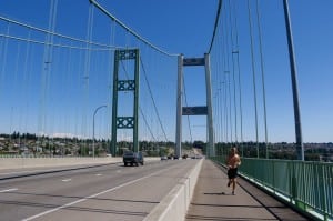
Rebuilt 10 years later — and with a second bridge added in 2007 — the Tacoma Narrows Bridge no longer gallops. Instead, it is of one of the more beautiful walking, running and biking routes in Tacoma, boasting sweeping views of the Puget Sound, Mount Rainier and the Olympic Mountains.
Getting There
Parking at the War Memorial Park on the Scott Pierson Trail in Tacoma, bikers, walkers, runners and skaters get an up-close and personal experience with the Tacoma Narrows Bridge. The Scott Pierson Trail is a 5-mile trail that crosses Puget Sound on the new Tacoma Narrows Bridge, giving stunning views of the Olympic Mountains, Mount Rainier and the waters below. The trail is paved, easy to follow and is both dog- and family-friendly, making it a perfect destination for everyone. On sunny days, foot traffic on the Tacoma Narrows Bridge is steady, as the route is full of bikers and runners getting their workouts in under the bridge’s iconic towers. During the evening, a few commuters work their way across, as do locals walking off a long day or getting in some much needed exercise for their kids or pets.
Take In the View
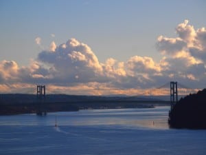
The walk across the Tacoma Narrows Bridge is something every resident of Washington should experience at least one — and not just because of the history. The walk has four major views that need to be seen to fully appreciate the region, and each is just a few hundred feet from the last. The first view is from the end of War Memorial Park, looking toward the bridge and the Kitsap and Olympic Peninsulas. Above the hills on the southern end of the Kitsap Peninsula, the Olympic Mountain range juts out, exposing the rocky summit of The Brothers. This is also the direction to look during sunset in the fall and spring months as the sun plunges behind these peaks.
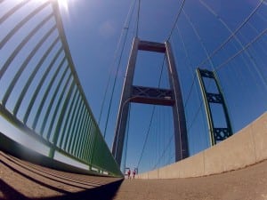
Further along the path, the next impressive view is of the bridges and towers themselves. The path across the Narrows is on the outside of the newer bridge, which heads west to Tacoma. Whether you are walking, biking or running along the path, slow down to take in the sheer scale and size of the cables and towers rising more than 300 feet above you. Standing on this architectural marvel, it is hard to imagine that just over 75 years ago, the only route across was by ferry. One of the more impressive views of the towers and cables is from along the first section of the bridge, where you get to stand next to the cable as it starts its steep rise to the top of the first tower. Look for eagles, osprey and even peregrine falcons sitting on top.
The next view from the Tacoma Narrows Bridge is of the water. At its highest point, the path across the Narrows is over 200 feet above the water, making the boats, trains, seals and occasional orca whales seem tiny far below your feet. Looking south, views of Titlow Park are visible; and on a clear day, one can almost see the Chamber’s Bay Golf Course and Nisqually Wildlife Refuge. To the north, and across both the traffic of the newer and older bridge, the view is fantastic for those hoping to look out toward Point Defiance and Five Mile Drive. For those daring enough, feel free to take a peak over the edge of the bridge and look straight down into the Sound, possibly seeing some of our incredible wildlife. If you do this, please remember to be safe and hold onto your hats and glasses.
Finally, one of the most iconic views of the entire Pacific Northwest is visible from the bridge. Looking back toward Tacoma, Mount Rainier becomes visible for the bikers, runners and walkers making their way east, looming large over the homes and businesses along Highway 16. This view is impressive all day long, but it is best during either sunrise or sunset when the first and last light turns the sky around this majestic volcano pink. During sunset, it is hard to find a better sight anywhere in Tacoma.
Grab a Buddy and Go
Running, walking or biking the bridge can be done by anyone at any time, but for those looking for more structure, there are numerous events year round that help get you out and active on one of Washington State’s most impressive bridges. Runners should contact South Sound Running to find out about events, such as the Tacoma Narrows Half Marathon. Bikers and walkers should look online and locate community calendars to help find events. Since the bridge is open and free to cross on foot, events can be hard to come by. However, if you grab a friend or two, park at the War memorial and walk, bike or run across, it is sure to be a day to remember, offering views, experiences and history unlike any other trail in Tacoma. The Tacoma Narrows Bridge is one of the best day trip destinations, and since it is often overlooked, consider making it your destination this weekend.


